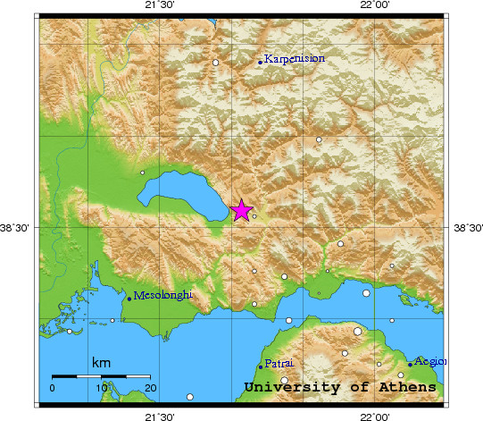
Event-ID: ev110526205351
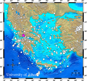
26 May 2011 (146) Greece
Location estimate (+/- standard deviation)
Origin time 20:53:45.5 +/- 0.6 sec
Latitude 38.53 N +/- 7.5 km
Longitude 21.69 E +/- 7.2 km
Depth 31.5 km +/- 12.7 km
Magnitudes:
ML=0.0 (0) ml=1.4 (9) mB=0.0 (0)
Median=1.2 (9)
90-Percent confidence region ellipse:
Semi-major axis 47.4 km strike: 137.4 deg
Semi-minor axis 30.8 km
Origin time error 2.6 sec
Autoloc alert ev110526205351: determined by 9 stations
LocSAT solution (with start solution, 9 stations used, weight 9):
Greece ml=1.4 2011/05/26 20:53:45 38.53 N 21.69 E 32 km
Stat Net Date Time Amp Per Res Dist Az ml ML mB
UPR HP 11/05/26 20:53:51.6 9.9 0.6 -2.1 0.3 162 1.5 0.0 0.0
EFP HP 11/05/26 20:53:52.7 16.5 1.8 -0.3 0.2 121 1.2 0.0 0.0
LAKA HA 11/05/26 20:53:53.2 32.8 1.2 -2.0 0.4 142 1.7 0.0 0.0
SERG HP 11/05/26 20:53:55.3 23.4 1.7 0.9 0.3 112 1.4 0.0 0.0
AXS HP 11/05/26 20:53:57.0 622.1 1.0 1.3 0.4 216 3.1 0.0 0.0
KLV HL 11/05/26 20:53:57.5 5.6 1.3 -0.7 0.6 143 1.0 0.0 0.0
DRO HP 11/05/26 20:53:58.0 7.6 1.6 0.2 0.6 178 1.1 0.0 0.0
ALIK HA 11/05/26 20:53:59.2 0.5 0.4 3.4 0.4 129 0.5 0.0 0.0
THL HL 11/05/26 20:54:03.4 3.4 2.1 -0.6 1.1 14 0.8 0.0 0.0
RMS-ERR: 0.80
First location: 2011/05/26 20:56:29 UTC
This location: 2011/05/26 20:56:30 UTC
|